Current Projects (Click to Expand a Project)
SankofaPOWER
Quick Description
Currently helping to map out an exciting new vision and toolkit for our local food ecosystem in Minneapolis and beyond.Website GIS Curriculum
Past Projects
SpikeAlerts
Quick Description
Managed a project to create an open-source text alert and community reporting system for connected to the City of Minneapolis' Community Air Monitoring Project. This project is tabled for the moment, but we would be happy to meet with folks to continue this work!Website
Cumulative Impacts in Minneapolis (Air Quality)
Abstract
It is understood that some parts of Minneapolis experience a greater burden of environmental hazard than others. Anecdotally and visually, this can be correlated to racially-restrictive housing practices of the early to mid 20th century. This project aims to quantify the cumulative environmental harms across Minneapolis at a fine spatial resolution with the intention of spatially correlating this with historic restrictive housing practices and modern demographics - continued here.(Part I | Part II | Part III)
Repository - Hazard Index Pollution Web Map - Minneapolis
Visualizations
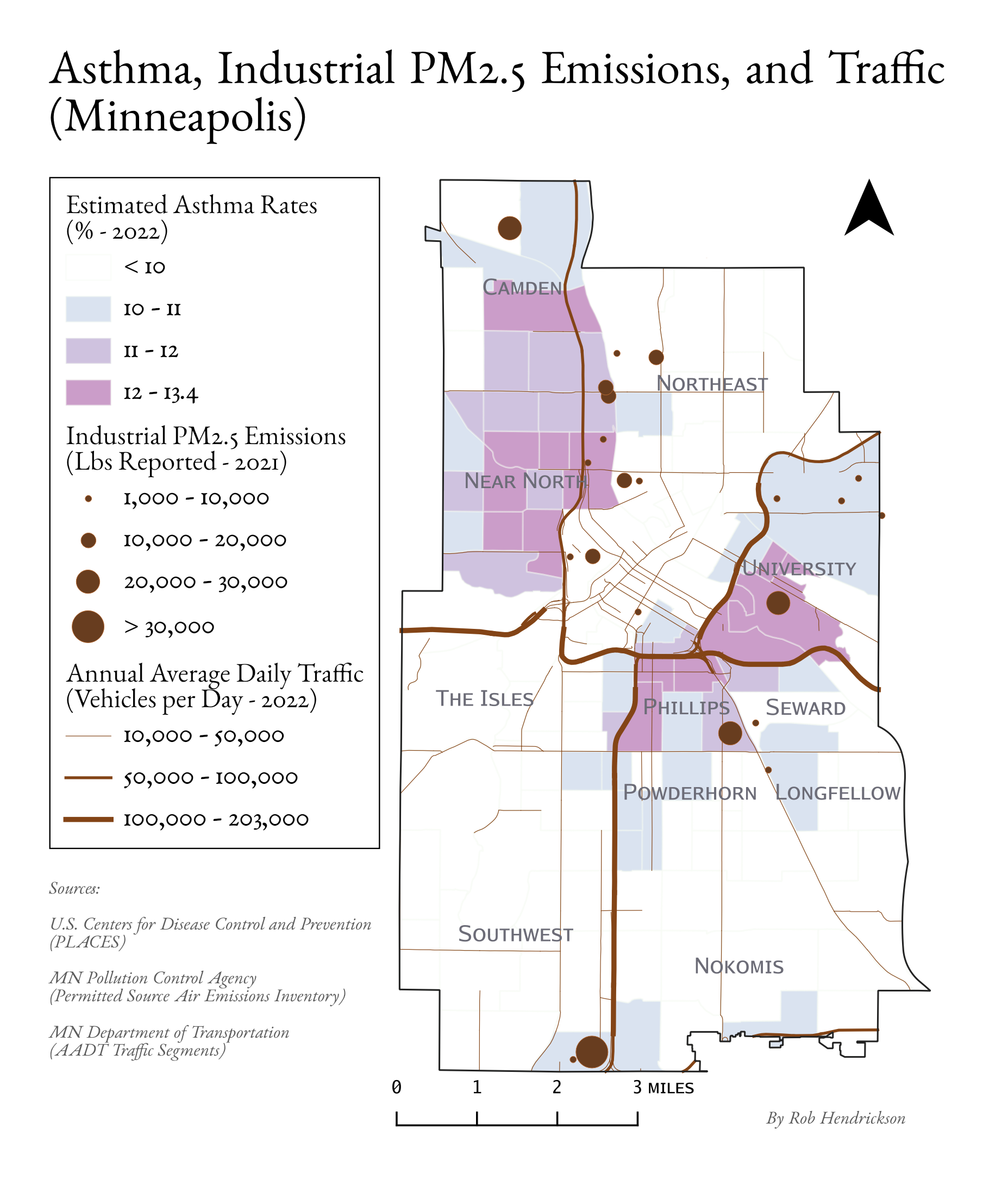
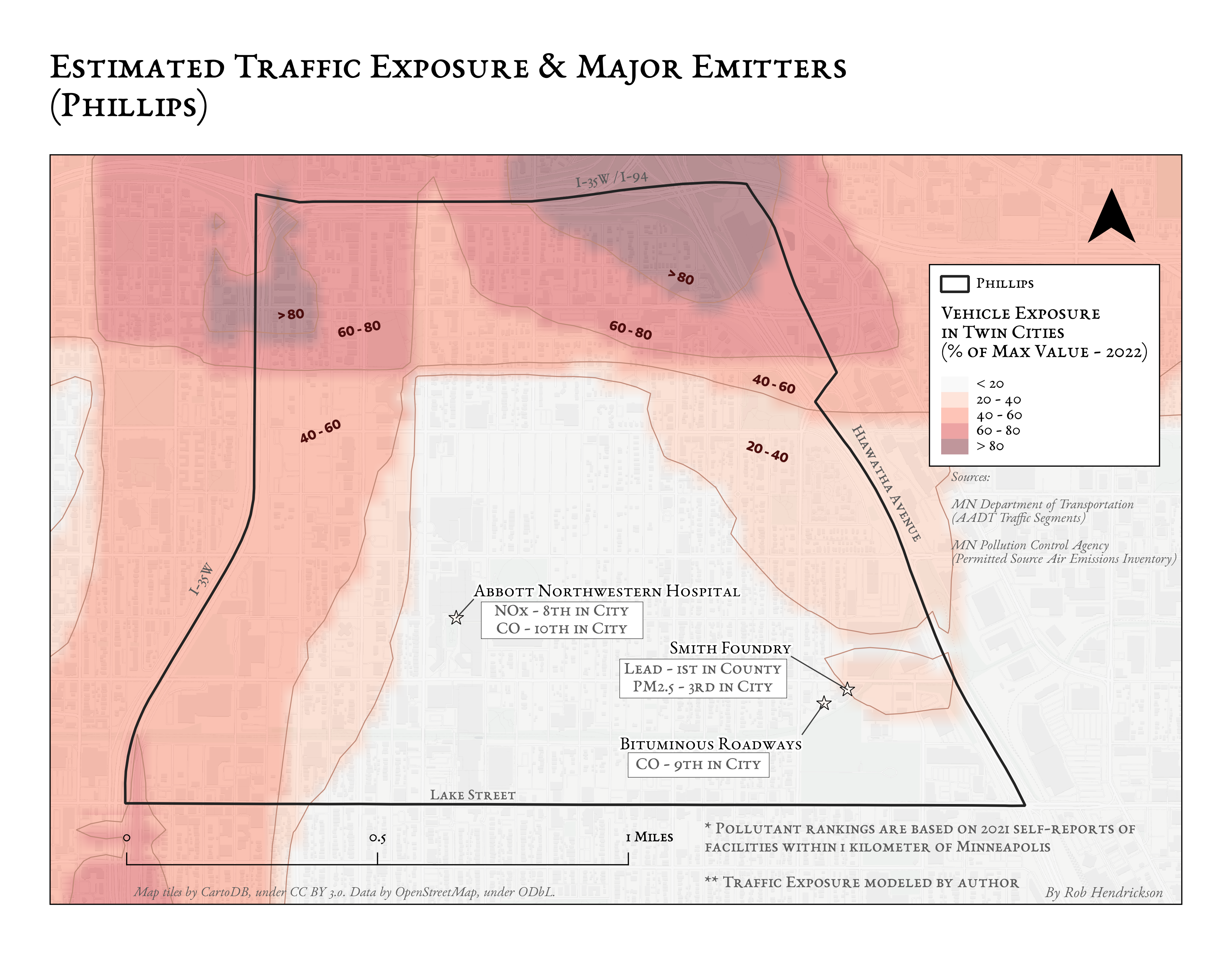
Example PM2.5 Air Quality Hazard Index
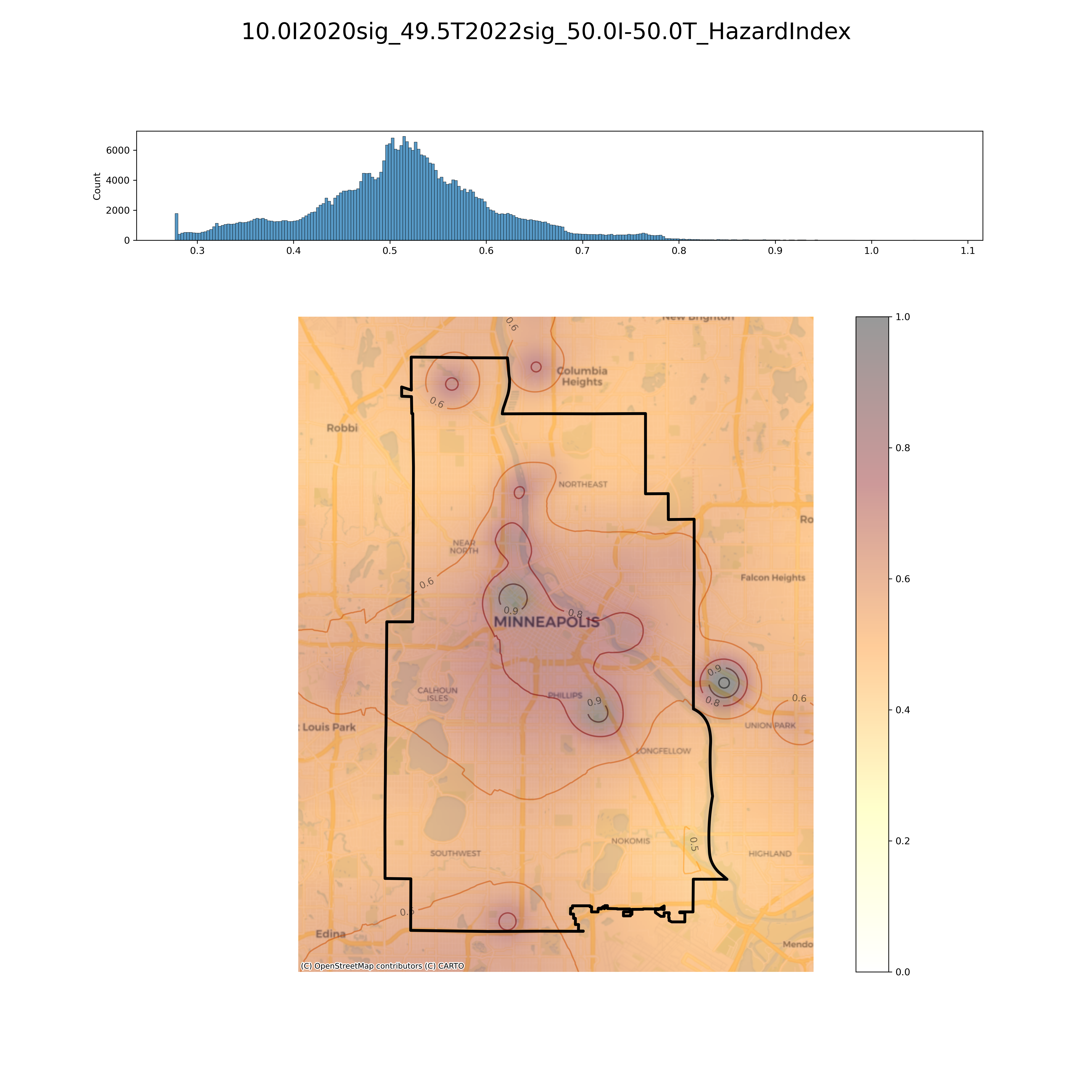
Data Sources
MPCA's Permitted Industrial Emissions
MnDoT's Annual Average Daily Traffic (AADT)
PLACES Asthma Rates
Twin Cities Mobility & Pollutants
(Slides | Recording)
In this project, I worked with Dr. Di Zhu and the GeoDI lab to explore the scaling relationships between human mobility and pollutants in the Twin Cities Metropolitan Area (TCMA). This involved:
- Cleaning and aggregating large datasets of:
- Unique mobile device trajectories in the TCMA
- Daily carbon dioxide emissions (Source)
- Computing human mobility indices at various time scales
- Exploring relationships between mobility indices and municipal carbon emissions
Visualizations

Mitigating Runoff on the St. Paul Campus
The goal of this project was to find the most cost-effective storm-water runoff mitigation strategy for the St. Paul Campus of the University of Minnesota.
This involved use of ESRI's Model Builder to create workflows that computed rasters representing Rainfall at Surface (RAS) and Surface Absorption (SA) across the study area. Watersheds and flow accumulation were approximated as well using Digital Elevation Model (DEM) data.
Upon diagnosing the current condition of the campus’ storm preparedness, mitigation measures were proposed to bring net runoff of each watershed to zero.

Modeling Cercarial Dermatitis
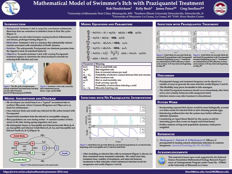
In the summer of 2016, I participated in an undergraduate research experience at the University of Wisconsin – La Crosse. Following their crash course in mathematical ecology, my mentors, Dr. Greg Sandland and Dr. James Peirce, paired me with another undergraduate student, Kelly Buch.
Tasked with finding our own research topic, my partner and I scoured countless articles and research papers. We eventually resolved to study cercarial dermatitis, also known as swimmers’ itch, because the control practices at that time were particularly harmful to lake ecosystems. By the end of the summer, we had built our own mathematical model of the parasite-host dynamics and coded a specialized RK4 differential equation solver into Matlab. This allowed us to experiment with more ecologically sound treatment methods and devise recommendations for lake management across the Midwest.
We later presented our project at the 2017 Joint Mathematics Meeting in Atlanta, and our preliminary work led to a publication in 2020 by Dr. Peirce and Dr. Sandland, in which we are acknowledged.